Farol de Ponta Moreia
| Farol de Ponta Moreia | ||
|---|---|---|
 | ||
| Ort: | Ponta Moreia Santiago Kap Verde | |
| Lage: | Tarrafal, Ilhas de Sotavento, Kap Verde | |
| Geographische Lage: | 15° 20′ 25″ N, 23° 44′ 33″ W | |
| Feuerhöhe: | 97 m | |
|
| ||
| Nenntragweite weiß: | 6 sm (11,1 km) | |
| Funktion: | Leuchtturm | |
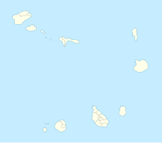
Der Farol de Ponta Moreia ist ein Leuchtturm an der Nordspitze der Insel Santiago, einer der Ilhas de Sotavento, des atlantischen Inselstaates Kap Verde. Der Leuchtturm steht an der Spitze der Landzunge Ponta Moreia. Der Leuchtturm wird von der Direcção Geral de Marinha e Portos (DGMP) betrieben.[1]
Geographie
[Bearbeiten | Quelltext bearbeiten]Ponta Moreia ist der nördlichste Punkt der Insel Santiago. Er liegt ca. 2 km nördlich des Dorfes Fazenda und gehört zum Concelho Tarrafal.
Architektur
[Bearbeiten | Quelltext bearbeiten]Die Konstruktion ist ein quadratischer, weiß gestrichener Turm. Das Leuchtfeuer befindet sich in 8 m Höhe über dem Boden und in 96 m Höhe. Es ist eine rote Laterne. Das Leuchtzeichen besteht aus fünf Blitzen in einer Periode von 20 Sekunden.[2]
Identifikationen: Amateur Radio Lighthouse Society (ARLHS): CAP-0.; PT-2150 – United Kingdom Hydrographic Office (Admiralty): D2888 – National Geospatial-Intelligence Agency (NGA): 113-24224.[3]
Siehe auch
[Bearbeiten | Quelltext bearbeiten]Einzelnachweise
[Bearbeiten | Quelltext bearbeiten]- ↑ DGMP. sia.cv.
- ↑ List of Lights, Pub. 113: The West Coasts of Europe and Africa, the Mediterranean Sea, Black Sea and Azovskoye More (Sea of Azov) (PDF; 3,2 MB). List of Lights. United States National Geospatial-Intelligence Agency. msi.nga.mil 2018: S. 427.
- ↑ Russ Rowlett: Lighthouses of Cape Verde. The Lighthouse Directory. University of North Carolina at Chapel Hill. ibiblio.org.
