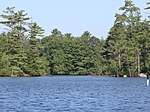
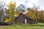
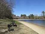
Dies ist eine Liste der State Parks im US-Bundesstaat New Hampshire . Die Verwaltung erfolgt durch die New Hampshire Division of Parks and Recreation. New Hampshire verfügt über 93 State Parks und deren zugeordnete State Historic Sites und weitere staatliche Schutzgebiete. Im Jahr 1993 wurden White Island und einige andere Inseln der Gruppe in das System der New Hampshire State Parks überführt und werden nun vom Bureau of Historic Sites verwaltet.
Name[ 1] [ 2]
County
Stadt
Koord.
Größe
Gegründet
Bild
Ahern State Park Belknap Laconia Lage 43.5555 -71.4973 52 ha (128 Acres)
1994
Androscoggin Wayside Park Coös Errol Lage 44.741667 -71.18 0,40 ha (1 Acre)
1958
Bear Brook State Park Merrimack Allenstown Lage 43.107 -71.352 4080 ha (10.083 Acres)
1943
Beaver Brook Falls Wayside Coös Colebrook Lage 44.92004 -71.4648 3,0 ha (7,3 Acres)
Cardigan Mountain State Park Grafton Orange Lage 43.656 -71.9103 2288 ha (5.655 Acres)
1939
Chesterfield Gorge Natural Area Cheshire Chesterfield Lage 42.9145 -72.4045 5,3 ha (13 Acres)
1948
Clough State Park Hillsborough Weare Lage 43.0967 -71.657 1964
Coleman State Park Coös Stewartstown Lage 44.9381 -71.3245 637 ha (1573 Acres)
1956
Crawford Notch State Park Carroll Hart’s Location Lage 44.178 -71.4 2337 ha (5775 Acres)
1913
Deer Mountain Campground Coös Pittsburg Lage 45.1911 -71.192
Dixville Notch State Park Coös Dixville Lage 44.863889 -71.293889 51 ha (127 Acres)
Echo Lake State Park Carroll Conway Lage 44.053 -71.157 48 ha (118 Acres)
Eisenhower Memorial Wayside Park Coös Crawford's Purchase Lage 44.239722 -71.425278 2,8 ha (7 Acres)
1979
Ellacoya State Park Belknap Gilford Lage 43.569444 -71.354722 33 ha (82 Acres)
1956
Forest Lake State Park Coös Dalton Lage 44.3534 -71.6759 161 ha (397 Acres)
1935
Franconia Notch State Park Grafton Franconia Lage 44.149444 -71.686667 2708,5 ha (6692,8 Acres)
1928
Gardner Memorial Wayside Park Sullivan Springfield Lage 43.4833 -71.9752 1980
Greenfield State Park Hillsborough Greenfield Lage 42.95841 -71.887 160 ha (400 Acres)
Hampton Beach State Park Rockingham Hampton Lage 42.932 -70.7981 20 ha (50 Acres)
1933
Jenness State Beach Rockingham Rye Lage 42.9856 -70.7619 0,53 ha (1,3 Acres)
1980
Jericho Mountain State Park Coös Berlin Lage 44.496389 -71.256389 3010 ha (7430 Acres)
2005
Kingston State Park Rockingham Kingston Lage 42.929 -71.055 18 ha (44 Acres)
Lake Francis State Park Coös Pittsburg Lage 45.061 -71.301 15 ha (38 Acres)
1976
Lake Tarleton State Park Grafton Piermont Lage 43.9836 -71.9758 19 ha (48 Acres)
Madison Boulder Natural Area Carroll Madison Lage 43.93146 -71.1678 6,9 ha (17 Acres)
1946
Milan Hill State Park Coös Milan Lage 44.572222 -71.223056 41 ha (102 Acres)
1939
Miller State Park Hillsborough Peterborough Lage 42.859444 -71.883056 216 ha (533 Acres)
1891
Mollidgewock State Park Coös Errol Lage 44.7378 -71.1439 19 ha (46 Acres)
1972
Monadnock State Park Cheshire Jaffrey Lage 42.8625 -72.0675 412 ha (1017 Acres)
Moose Brook State Park Coös Gorham Lage 44.407778 -71.230556 306 ha (755 Acres)
1936
Mount Sunapee State Park Merrimack Newbury Lage 43.3211 -72.0623 1171 ha (2893 Acres)
1948
Mount Washington State Park Coös Sargent's Purchase Lage 44.269419 -71.301699 24,4 ha (60,3 Acres)
1964
Nansen Wayside Park Coös Milan Lage 44.533056 -71.17 5,7 ha (14 Acres)
North Hampton State Beach Rockingham North Hampton Lage 42.9537 -70.7836 0,45 ha (1,1 Acres)
1980
Northwood Meadows State Park Rockingham Northwood Lage 43.2132 -71.1981 273,0 ha (674,5 Acres)
1990
Odiorne Point State Park Rockingham Rye Lage 43.043611 -70.714444 135,0 ha (333,7 Acres)
1961
Pawtuckaway State Park Rockingham Nottingham Lage 43.101944 -71.181111 2240,4 ha (5536,1 Acres)
Pillsbury State Park Sullivan Washington Lage 43.230833 -72.099722 1803 ha (4456 Acres)
Pisgah State Park Cheshire Chesterfield Lage 42.840278 -72.453611 5407 ha (13361 Acres)
1967
Rhododendron State Park Cheshire Fitzwilliam Lage 42.784722 -72.191111 1102 ha (2723 Acres)
1947
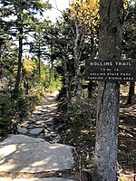
Rollins State Park Merrimack Warner Lage 43.345833 -71.849444 48,0 ha (118,5 Acres)
1950
Rye Harbor State Park Rockingham Rye Lage 43.0017 -70.7446 25 ha (63 Acres)
1936
Sculptured Rocks Natural Area Grafton Groton Lage 43.707222 -71.855556 110 ha (272 Acres)
Silver Lake State Park Hillsborough Hollis Lage 42.7625 -71.593333 32 ha (80 Acres)
1954
Umbagog Lake State Park Coös Errol Lage 44.7023 -71.0555 55,0 ha (136,0 Acres)
1998
Wadleigh State Park Merrimack Sutton Lage 43.3572 -71.9453 17 ha (43 Acres)
1934
Wallis Sands State Beach Rockingham Rye Lage 43.027778 -70.728889 12 ha (30 Acres)
1964
Weeks State Park Coös Lancaster Lage 44.450278 -71.570556 170 ha (420 Acres)
1941
Wellington State Park Grafton Alexandria Lage 43.641 -71.7789 83 ha (204 Acres)
1931
Wentworth State Park Carroll Wolfeboro Lage 43.6131 -71.1478 20 ha (50 Acres)
1934
White Lake State Park Carroll Tamworth Lage 43.8409 -71.2222 365,3 ha (902,7 Acres)
1933
Winslow State Park Merrimack Wilmot Lage 43.3901 -71.8679 1935
Andere bemerkenswerte Gebiete, die sich noch im Besitz des Staates befinden, aber nicht gepflegt werden.
Name[ 2]
County
Stadt
Koord.
Größe
Gegründet
Bild
Bear's Den Natural Area
Cheshire
Gilsum
38 ha (95 Acres)[ 4] [ 5]
Binney Pond Natural Area
Hillsborough
New Ipswich
40 ha (99 Acres)[ 6]
Bradford Pines Natural Area
Merrimack
Bradford
2,0 ha (5 Acres)[ 7]
Crosby Mountain State Park
Grafton
Groton
35 ha (86 Acres)[ 8]
Gestiftet 1971
Curtiss Dogwood Natural Area
Hillsborough
Wilton
5,7 ha (14 Acres)
Dublin Lake Scenic Area
Cheshire
Dublin
0,53 ha (1,3 Acres)
Heath Pond Bog Natural Area
Carroll
Ossipee
557,9 ha (1378,5 Acres)[ 9] [ 10]
Humphrey's Ledge Natural Area
Carroll
Bartlett
15 ha (36 Acres)[ 11]
Jeremy Mill Natural Area
Hillsborough
Pelham
25 ha (63 Acres)[ 12] [ 13]
Mascot Mine Natural Area
Coös
Gorham
4,7 ha (11,7 Acres)[ 14]
Ossipee Lake Natural Area
Carroll
Ossipee
160 ha (400 Acres)[ 15]
Otter Brook Lake
Cheshire
Keene
1,0 ha (2,5 Acres)
Smith's Ferry Heritage Park
Hillsborough
Manchester
6,9 ha (17 Acres)[ 16]
Urban Forestry Center
Rockingham
Portsmouth
Lage 43.0441 -70.7688 74 ha (182 Acres)[ 17]
Wantastiquet Mountain Natural Area oder Wantastiquet State Forest
Cheshire West Chesterfield 407 ha (1006 Acres)[ 18] [ 19]
↑ State Parks. nhstateparks.org. New Hampshire Division of Parks and Recreation, abgerufen am 7. Juli 2019 . ↑ a b NH Forests, Parks, Natural Areas and Other. Original 3. März 2016 ; abgerufen am 20. Februar 2017 . ↑ Historic Sites. nhstateparks.org. New Hampshire Division of Parks and Recreation, abgerufen am 10. Oktober 2020 . ↑ Bear Den Geological Park & Trail. abgerufen am 18. Februar 2017 . ↑ Bear's Den Natural Area. abgerufen am 18. Februar 2017 . ↑ Binney Pond Wildlife area access, Wapack Trail - New Ipswich, NH. abgerufen am 18. Februar 2017 . ↑ Bradford, NH Trails and Public Lands Map. abgerufen am 20. Februar 2017 . ↑ Cockermouth Forest - Bald Knob & Mt. Crosby: 4/30/09. abgerufen am 20. Februar 2017 . ↑ Heath Pond Bog. abgerufen am 20. Februar 2017 . ↑ Heath Pond Bog Natural Area. abgerufen am 20. Februar 2017 . ↑ Humphrey's Ledge. abgerufen am 20. Februar 2017 . ↑ Fire Towers. abgerufen am 20. Februar 2017 . ↑ Conservation Map 2008. abgerufen am 20. Februar 2017 . ↑ Going "Batty" Trying to Avoid the Rain (Mascot Pond: 18-Jun-2009). abgerufen am 20. Februar 2017 . ↑ Ossipee Lake Natural Area. abgerufen am 20. Februar 2017 . ↑ Greening the City Master Plan. S. 109 , abgerufen am 20. Februar 2017 . ↑ Urban Forestry Center. abgerufen am 20. Februar 2017 . ↑ Wantastiquet Natural Area Summit Trail. abgerufen am 18. Februar 2017 . ↑ Map. abgerufen am 20. Februar 2017 .


